Showing posts with label drones. Show all posts

Saturday, August 30, 2025

Checking out the new USGS building in Hilo, with drones!

There's a new building under construction on the UH Hilo campus (near to several places I have worked/am working), which when completed will house the USGS Hawaiian Volcano Observatory (HVO) and the USGS Pacific Island Ecosystems Research Center (PIERC). It's replacing a previous HVO building which was located in Hawaiian Volcanoes National Park and was damaged in Kīlauea's 2018 eruption; this new one will be closer to staff who live in Hilo and students from the UH campus. Preparation of the lot started last year but construction really picked up this spring, and since I drive by it most days I've been able to watch its progress. And as a construction site not really near lots of people, I felt comfortable bringing out my Avata for some FPV exploration.

Along with my Mini 3 Pro; the video below contains footage from both. This was recorded on the 4th of July weekend, though I had to go back and reshoot the FPV footage on a different day because I was still figuring out which lens profiles worked with Gyroflow for post-production stabilization. (Note to self: It's the Wide profile that works, not Normal or [as you might think] Extra Wide). It's a slight shame since the weather was absolutely beautiful the first day, but the FPV footage I got the second time was better overall so it all works out.

I'm pretty happy with the resulting video. I couldn't really figure out a way to make a single long FPV shot look good, but I like the cutting between wide establishing shots and the more interesting individual fly-throughs. The music actually does stop like that halfway through (though I extended the pause slightly), and when I saw that collision in my footage I thought it was too funny not to sync them up. The recovery makes me smile, as I had basically nothing to do with it – the Avata can sometimes autonomously recover from collisions when you'd hardly expect it to.

It turns out I got that footage at pretty much the optimal point in the construction process as just the next week they started filling in the walls, making the main building less see-through and (probably) harder to fly through. I hope I get a chance to visit when it's complete, as they're going to have some amazing views of Mauna Kea, Mauna Loa, and the Saddle between them from that north lanai. We'll see how it goes! I don't know how much longer construction will take, but I'd imagine it'll finish sometime next year. A hui hou!

Sunday, April 13, 2025

Relaxing waves in Hilo bay

I'm starting my new job tomorrow, so I may be a bit preoccupied with that for a while as I settle into a new routine. I know some generalities about what I'll be doing, but the particulars remain to be discovered. (Though I'm expecting to be rather sore and tired for the next week or so.) I'll probably get some posts out of it in the future, at least!

Earlier this week, though, I took the opportunity of some high-surf days to get some drone footage of waves crashing over the breakwater in the bay and turned it into this video:


The observant may remember I did a similar video last year. While that one was taken in overcast, almost stormy conditions, the high surf days this week were on gorgeous, mostly-clear days, which made for a nice contrast. Where I went with some fast-paced music with that video, this one got some calmer music, slower editing, and some nice relaxing wave sounds. Anyway, hope you enjoy it! A hui hou!

Friday, February 28, 2025

Visiting Indonesian watefalls

While I was visiting my parents in Java we went to see some nearby waterfalls, and since we didn't get rained out this time I was able to get my drone in the air for some video. I actually didn't think to take too many photos as a result, but I got a few from my vantage point on the ground.

Coban Palangi.

The first one we visited was Coban Palangi; “coban” means waterfall, and “palangi” means waterfall (with the ‘c’ being pronounced like a ‘ch’). This was the tallest and most visually impressive one, as it plunged over the rim above and generated a lot of mist in the valley below. It was overcast when we visited, so we didn't get to see a rainbow. (And why the photo looks somewhat washed out.)

Here's a shot of Coban Palangi from above. It was the most open of the three waterfalls, allowing me more freedom to maneuver and get different angles. That openness also required the most hiking, down from the road above into the valley where it was.

Coban Toris.

The next day we visited two more waterfalls near each other, Coban Toris and Coban Tarzan. These were both smaller waterfalls tucked away under canopies of foliage, which made them feel a bit cozier and meant I had to get creative with the limited range of drone shots I could get.

Coban Tarzan.

But if you'd rather see these watery wonders in motion, check out the video below from the footage I was able to take:

One interesting thing I did notice while hiking (and flying my drone) in the Javan rainforest is that there seemed to be very few flowers visible from above the treetops. Not that every tree here in Hawaii has flowers, but we do have a lot of the invasive African tulip tree which always seem to have a lot of bright orange flowers visible from above. I haven't tried to quantify the difference, but it was something I noticed while looking out across the jungle canopy while hiking into and out of the valleys where the waterfalls were.

Not much more to say about this, other than that I'm glad the weather cooperated after getting rained out at the tea plantation tour. I like waterfalls, as I'm sure is pretty clear from this blog, so it was neat getting to see some in other contexts and locations. A hui hou!

Sunday, June 30, 2024

A late tau day, and some cruise ship photos

First of all, happy belated Tau Day! I remembered to bring it up at work on Friday and forgot to note it here. I'm going to blame the bout of COVID-19 I had last week making me a bit scatter-brained.

Second, two weeks ago I went flying over the bay with the intent of catching a cruise ship leaving in a hyperlapse. I actually managed to pull off a pretty good one, where I got my drone to focus on the ship while executing a sideways move, creating a very dynamic video. However, the experience has also cemented my previous opinion that hyperlapses involving the ocean just fundamentally don't work, at least with the Mini 3 Pro where the fastest interval between frames is two seconds (for reference, that rate compresses fifty seconds' worth of time into each second of the hyperlapse, at 25 fps). Going over land, that frequency isn't a big deal, as the land itself generally isn't moving noticeably so any movement comes from the drone. Over the ocean, though, the surface waves which are so slow and relaxing in real-time become a series of flickering monstrosities when sped up fifty times. It's not something that can be handled by, say, slowing the drone's speed, because it's inherently part of the environment. Perhaps if I can slow it down a bit I'll share it, because it's otherwise a pretty neat clip, but I just don't like how the waves look when sped up that much.

I did take a few normal video clips of the ship as it got out of the harbor and onto the open sea, and while they don't really come together into a cohesive video I at least managed to get some interesting still frames from them that I wanted to share:

I quite like how the ship's silhouette carves into the Sun's reflection.

A top-down view of the pool as I flew over.

Looking back towards shore.

And out towards the open ocean. Full steam ahead!

I've mentioned on this blog that it's been a very rainy winter and spring here in Hilo so far this year, and even now as we get into summer we still have a lot of overcast and rainy days. (I'm not complaining, as it keeps things cooler with the AC out at work.) We have, however, started to have some more sunny and clear days like this one recorded here, and it's been nice to get out and fly again after not flying at all in May. I'm looking forward to doing more flying in the near future, so we'll see what that produces (there's a waterfall I've been wanting to revisit for months now). A hui hou!

Tuesday, May 14, 2024

A new view of the Wailuku

It's been so rainy for the past few months that I haven't had many chances to put a drone in the air. Last Friday we had an absolute downpour of up to 3 inches per hour for a short time, which caused a pretty widespread power outage including at the Gemini offices. I heard of one person in Piʻihonua whose rain gauge went from empty to 7 inches over the course of the day. A few weeks ago the rain let up long enough for me to get in a flight, and while the lighting isn't the best as it was still overcast I thought the photos I got were interesting enough to share.

I've been vaguely aware that there's a small hydroelectric power station in Hilo on the Wailuku River for some years now (it gets mentioned in the occasional local news article), but didn't actually know where it was located. There's an electrical station next to the river near downtown which I thought was associated with it, but I recently learned that it's actually upstream, outside the city proper above Waiale Falls (in Piʻihonua, actually).

I'm pretty sure that's it in the photo below, given the water coming out (though I don't know where the intake is). It's not very large, which makes sense since the Wailuku, though it reliably flows all year, spends most of its time in a very low flow state that can't be providing that much energy. I found myself more enchanted by the rest of the scene, with the emerald-green grass and the Wailuku rising up the mountain side, a distant waterfall barely glimpsed in the distance. It's quite idyllic…though the invasive Molucca albizia trees growing on the right shore spoil the mood a bit. (They grow faster than native trees and crowd and shade them out, but are pretty fragile and easily drop large branches, making them dangerous during storms.)

Anyway, that's all for now. I just wanted to share a nice photo of a new part of the Wailuku I hadn't really explored before. A hui hou!

Thursday, February 29, 2024

Honoliʻi beach at dawn

It's been a busy few weeks here, with several people from my team at work who are normally remote being in town last week for a series of team meetings, socializing, and planning sessions. It was nice to see people in person (and we got a tour of the telescope!), but possibly as a result of all that close contact I came down with a cold on Sunday (which I'm finally mostly over today, thankfully).

However, the week before all that, I drove a short way up the coast around sunrise to Honoliʻi beach, one of the few beaches on this side of the island considered to have any waves worth surfing. It's at the mouth of the Honoliʻi stream, and is one of the relatively rare places along the Hāmākua coast where its usual sea cliffs give way to a beach and have a slope shallow enough to permit walking to the shore. (Honoliʻi means “little valley” in Hawaiian, if you were wondering, which is both descriptive and rather cute.)

An aerial view of Honoliʻi beach, with a bridge over the mouth of the stream.
Honoliʻi beach and the mouth of the stream.
The morning was bright and clear, and I saw something my housemate Jonathan and I chased several times in vain over a decade ago: a horizon free of clouds for the sunrise! I had begun to think it didn't happen. But the sunlight was dazzling reflecting off the water, which led me to an interesting discovery.

You see, I've got some circularly-polarized lens covers on my drones, one benefit of which is that they block glare from linearly-polarized light reflecting off flat surfaces like water. It partially depends on the angle of the Sun, and while I was conceptually aware of what they did, this flight was the first time I really noticed. With the ocean as smooth as it was, you can see the ocean floor in the image above for quite a ways out from shore. And the water definitely wasn't this transparent to the naked eye by any means, so I was really a bit shocked at how well I could see through it with the filter. Here's another shot from a slightly different angle looking back along the coast towards Hilo; notice how clearly the rocks on the ocean floor are visible near the bottom of the image:

The beach from a different angle.
It was really quite eye-opening, no pun intended. I've always found water too deep to see the bottom of unnerving (one reason I don't spend much time in the ocean), and tend to assume the land drops off quickly. Whereas, from what I could see during this flight, it's actually fairly shallow even a ways from the shore, and slopes down gently. (Which isn't too surprising, given it's a shield volcano with very gentle slope, but our minds fill in assumptions for what we cannot see.)

One last bonus photo, if you follow Honoliʻi stream back from the ocean you come to a nice plunge pool and Makaila falls, surmounted by a bridge carrying the original road up the coast (the current highway uses the bridge seen in the first photo). The name of the falls means “young shoot, as for transplanting,” apparently. It's a lovely, serene place that isn't easily reachable by land. Which I'm beginning to realize is true of many of the waterfalls on the Hāmākua coast, the more I explore with my drone. For every Akaka falls and Rainbow falls, there's another set of falls that can't be easily reached or seen, perhaps not quite as spectacular or breathtaking, but beautiful in its own way. I've started planning out trips based on where I can see falls on Google Maps, trying to find new spectacles to enjoy and share. So you can expect more waterfall photos from me in the future.

Makailo falls.
Having flown up the stream with the Sun at my back lighting the way, I had a bit of a nasty surprise when I tried to turn around and return: the Sun was still so low in the sky that it was shining almost directly down the valley, and the backlighting of leaves and lens flare made it a dicey proposition to try to fly back out. Fortunately, this was actually my second time flying around Makailo falls (the first was back in July of ʻ22 when I stopped near the bridge in the photo), and I knew the pool itself had a clear view of the sky. Combined with the Mini 3 Pro's ability to look upwards better than a lot of drones, I was able to fly straight up out of the jungle and safely back above the trees. All's well that ends well, as they say! A hui hou! And happy leap year!

Saturday, February 17, 2024

High surf days in Hilo

In February of last year, I don't think I saw the Sun for the entire month. This year has had nicer weather in comparison, but where last winter saw us receiving torrential rain, this year's theme has been “high winds.” I'm not sure of the exact number, but we've lost probably in the range of a week or two of observing nights due to winds exceeding 50 mph on the summit over the course of January and February to date. While the winds don't get that high in Hilo (outside of hurricanes), they've definitely been noticeably stronger on numerous days this past month.

One effect of that has been a lot of high surf warnings, and that led me on the 2nd to fly my drone out to the Hilo bay breakwater to capture the waves rolling over it majestically one late afternoon. Serendipitously, a hole in the clouds opened to the west, letting the Sun shine in a bit and cast an unusual illumination over the scene. But enough talk, here's the video!


Normally the bay is much more placid (and ‘pacific’), so it's both a shock and a treat to see the waves crashing over the breakwater like that. There's just something about that motion, and the rippling of the sea's surface in general, that I find mesmerizing. Anyway, hope you enjoy the video! A hui hou!


Friday, December 22, 2023

An Arizona trip highlights video

I'm in the middle of a two-week vacation, which has provided me some much-needed time to rest and recuperate. I can tell I really needed this time off; normally, after two days of rest I've recovered my creative spark, but this time it's taken nearly five days to start to feel like doing much of anything. I say this by way of explanation for why updates have been so sparse around here, and hopefully I'll be able to get around to a few of the many projects I've got tucked away in my brain in the remainder of the year.

For this post, have a little video with some drone footage from my trip to Arizona. I took a motley collection of clips from a variety of locations, and have interwoven them in what seemed like an interesting fashion.

One location that shows up a few times is Cochise Stronghold (named for a famous Apache chieftain who held out and was eventually buried in the area). It's a large rock formation in the Dragoon Mountains, with a hiking path going up to it.

Cochise Stronghold (taken from the air with my Mini 3 Pro).

Another thing which shows up in the video a few times is the migration stop (or overwintering site, I'm not sure which) for sandhill cranes. As seen, there were a lot of them there; they're quite common and not endangered (estimated population in North America in the hundreds of thousands), and didn't seem to be all that bothered by my drone beyond a little unease, so I felt comfortable flying fairly close. It was incredible seeing what must've been thousands together like that; we don't really see anything like that here in Hawaii (or maybe I'm just not looking in the right places!).

A tiny fraction of the sandhill cranes present. They're fairly large birds, think “flamingo-sized.”

Also appearing a few times is the town of Pearce where I stayed. It's intertwined with a golf course built around half a century ago, which ultimately didn't prove successful. (I can only imagine the water bill to keep it green during the summer!) The holes meandered about through the town, and traces of them can still be seen all over the place, including the water hazard now being used as a reservoir for the vineyard seen at about 1:20 in the video.

Anyway, that's all for this post. I still have a few locations where I took enough photos to get another post or two out, but I wanted to get this video out to show off some of the bits and bobs of footage I got. A hui hou!

Tuesday, November 28, 2023

Visiting Arizona: the Titan Missile Museum

It's been pretty quiet here on the ol’ blog this month, due to me spending the first two weeks in Arizona: first at the ADASS 2023 conference, then a week visiting my parents for an early Thanksgiving. Those were two rather packed weeks, so after a week to decompress I'm finally sifting through the many photos and videos I took at various places; enough for a few posts, at least.

The first place we visited, after I flew in overnight and a day before ADASS started, was the Titan Missile Museum, located twenty minutes' drive outside of Tucson. It's a real Titan II missile bunker, the only one not destroyed as a result of disarmament treaties (though rendered permanently inoperable), and contains a real Titan II missile in its launch silo (though sans warhead, of course). You can walk down a few floors to the underground command station, see the authentic computers still in place, and then walk down a long corridor to see the missile itself.

Here it is, though this is only about half of the it; the rest extends downward further below. You can see how the top of the shaft is half-blocked by the immense door covering it, ensuring this silo is truly disarmed and can't be used.

Remarkably, when I asked about whether there drone restrictions in place, it turned out there weren't. Which allowed me to get this great shot of the entire complex:

You can see the outside of the silo here (what little there is of it above ground), and the half-open door blocked by huge weights. When it was active, it could apparently fully open in just 58 seconds. The glass roof allows looking in at the missile, both for viewers on the ground and – no joke – spy satellites, to ensure the missile doesn't have a functional warhead.

Not sure how they can actually see in, though.
Overall it was a neat experience, one that can recommend. It was also a somewhat sobering experience to hear the guide dispassionately explaining just how quickly these missiles could be launched (58 seconds), with their 9 megaton-TNT-equivalent warheads (large enough to pretty much vaporize 30 square miles). Definitely worth checking out if you're in the Tucson area and enjoy a bit of history! A hui hou!

Tuesday, October 24, 2023

Checking out the aftermath of the 2022 Mauna Loa eruption

Earlier this month I got up before the Sun and drove up the Mauna Loa access road to where the lava crossed it in its eruption last year to try to get some drone photos. I originally tried back in March when the access road was first re-opened, only to have the wind blowing so hard when I arrived that I had to brace myself with every gust to keep from falling over. Needless to say, no drone flying happened that day!

This particular day, however, had almost perfect conditions, with a mere gentle breeze blowing and crystal clear skies overhead. I got to the end of the road within fifteen minutes of the Sun making an appearance in order to get those long early morning shadows for contrast, as various guides to photography suggest you should do. In retrospect, I'm not sure this worked in my favor in this particular case; with the Sun still low in the sky it meant serious lens flare if I took a photo looking anywhere close to the east, and the vast lava fields didn't really have much in the way of notable topography when seen from afar to make interesting shadows. Still, it was a good learning experience!

Cars for scale.

Here you can see the road, the flow covering it, and where it continues past the flow. There are actually two places the flow crossed the road, and this is the smaller of the two. I flew out along the road further to where the main overflow happened, and I could barely see to the other side of that one; I'd estimate it's at least three times wider.

Here's another shot from upslope, looking across to Maunakea. You can see how the flow really doesn't continue very far below the road there. Also this perspective (and the extreme low angle of Hawaiian shield volcanoes) makes this view a bit misleading: it looks like it's basically flat across to Maunakea, but in reality this point is over 2,500 feet (750 m) above the saddle between them!

While I was there, I tried flying my drone up the slope as far as I could, to see if I could crest the ridge and look over towards Kīlauea. DJI drones have a 500 meter (1,640 ft) limit on how high you can fly above your take-off point, which is specifically for flying up mountains, since legally you can't fly higher than 120 m/400 ft above the ground. I flew as far as I could, but even at 500 m above where I took off the ridge was still higher! At least there was this neat-looking puʻu near where I had to stop, so I took a photo of it (one case where I think the low angle of illumination helped).

Finally, with my last battery, I tried flying down the slope instead. Coincidentally, where the lava crossed the road turns out to be almost directly mauka (upslope) of NASA's “HI-SEAS Analog Habitat,” a small shelter where people come out and stay for months on end simulating missions to Mars. (Interestingly, I know from an article I saw that the place is equipped with the exact same hydroponic garden set-up that I have.) It wasn't too far to reach, and I was able to get the photo above. It's the white dome nestled next to the cool rift vent system in the foreground. (But I couldn't resist getting Maunakea and Haleakalā in the background too! I couldn't get much lower down as I'd have had to fly below my local horizon.)

Overall it was a pretty fun experience, and I'm glad I finally got around to making the trip again (and the dawn chill reminded me to be thankful for the balmy temperatures in Hilo!). I got some video footage too, so I'll have to see if there's enough interesting material to make a video out of. At some point I expect the road will be re-built over (or through) the flows to regain access to the Mauna Loa Observatories where I used to work, at which point I'll probably come up again to check it out. But for now this will serve as a snapshot in time of when the road was closed. A hui hou!

Wednesday, September 27, 2023

A new drone!

So this post is actually several months late, for reasons I'll explain shortly. You see, back in May I got a new drone: the DJI Avata. I got it right before taking a trip to visit my family in California, and was excited to start sharing footage from it. One small problem: the video editor I use (KDEnlive) crashed every time I imported a clip into it. Not clips from my Mini 3 Pro, or GoPro 9, mind you, only the Avata.

I considered trying a different editor – maybe learning how to use Blender for video editing – but I'm busy, and lazy, and didn't get around to it. Fortunately, when I upgraded my computer from Debian 11 to 12 last month, something in amongst all the upgrades seems to have fixed the problem, allowing me to continue using what I know to make videos with Avata footage. Huzzah! And now that I can, have not just one, but two new videos!

Before that, though, a quick digression on types of drones, of which there are essentially two nowadays. They don't exactly have defined names (and all categories are blurry to some extent), but I've seen the name “flying cameras” to describe drones like my first one, the Mini 3 Pro. These are drones which are meant (generally speaking) for eye-in-the-sky photos or smooth cinematic video clips, up in air away from obstacles, since they're generally pretty delicate and a collision with almost anything will knock them out of the sky due to their unprotected propellers.

The other type is first-person view drones (or FPV). FPV drones project their camera feed directly on a headset instead of a controller, giving a pilot a more immersive experience which makes it somewhat easier to judge a drone's position and distance from obstacles. FPV drones generally focus on video rather than photos, and often from much closer to objects than the other type of drone. They're generally pretty hearty and damage resistant, and some (like the Avata) have propeller guards, allowing them to fly in close proximity to people and even potentially bounce off obstacles without getting knocked out of the air. (Though there are also ones without propeller guards.)

Since the Avata is so tough (as plenty of reviews on YouTube will attest), I wasn't too worried about letting my family fly it. There were some crashes, as expected (the Avata is good at getting you to take risks while flying it), and I thought splicing some of the resulting footage together could make for an amusing video. In this video, all the footage is from when my two brothers were flying (but while the crashing is amusing, lest you think they're terrible pilots I also included some non-crash footage to balance it out).


And to reassure that my drone is, indeed, still fine after those crashes, I have a second video. The footage for this was taken just a few weeks ago after discovering I could use it in my editor. This video was taken at Waiale Falls on the Wailuku river, not too far from where I live. The river's pretty low right now, so I thought I'd try flying up and down over the falls.


I wasn't originally planning to make a video out of this footage (hence why it's two clips put together rather than one long one), as my original motivation for taking it was trying out Gyroflow. Gyroflow is a program which can take GPS data embedded in a video file to stabilize it after it was taken, and a lot of people swear by it for video stabilization. It requires turning off any electronic image stabilization (such as I had on in the first video), and running the footage through Gyroflow after taking it, but I was impressed enough with the results that I decided to turn a few clips into the video above, and I can see why people speak so highly of it.

Anyway, I hope to be able to make and share some new types of videos with my Avata in future! One drawback it does have is that it's seriously loud. That's just par for the course for FPV drones since they need a lot of power, but it's not helped by the fact that it generally gets better footage when flown closer to the ground rather than up in the sky like my Mini 3 Pro. I dislike flying it around people, but it's a big island, so I'm sure I can find some nice secluded places to go flying.

And finally, while I know I've picked up two drones in less than a year since I started flying, I don't have plans to amass a large fleet or anything. I've got a representative of each of the two main categories of drone now, and while it's possible I might upgrade to newer models in future, they're both quite capable enough already that I don't see a big need to do so for a while. A hui hou!

Thursday, August 31, 2023

Fun with drones in the California countryside

Back in May I took a short trip over Memorial Day weekend to visit family back in California. This was the first time I'd been back since I starting drone flying last July, so I was looking forward to seeing some familiar places from the air. My brother Joel also has a drone (in fact he started flying before I did), so together with my other brother Jonathan we had some fun going drone flying together. After a session out in the countryside, as we were getting ready to come home I had the idea of following our car from the air (while driving slowly, on a deserted country road, with multiple people for extra situational awareness).

I've never operated from a moving vehicle before, and it was a fun experience practicing my cinematic moves trying to track the car while also riding in it. The full video was a bit too long to be interesting, but I extracted a few nice shots and put them together into the shorter version below. I'm especially proud of the bit near the end where, as we went under I-505, I managed to transition on the fly (literally!) from following mostly behind the car to instead tracking it from straight above. (I even left the ugly jerky animation bits in there which I've cut out from the rest of the video, just to show how it worked.)


Anyway, just a calm video of a relaxing drive through the countryside. (I've left out the parts where I almost ran into power lines…twice. It was fine.) And thanks to some recent system updates, I might have something new in a similar vein to show off pretty soon. A hui hou!

Sunday, July 30, 2023

Drones, geology, and the tropical sun: a case study

On the slopes of Maunakea, a short distance east of the Visitor Information Station and Hale Pōhaku, a small pit crater (sometimes evocatively called “Bottomless Pit”) can be seen on satellite imagery.

I've circled it in this wider view of the area, it's not very big.
I thought for sure I'd mentioned it before on this blog, but a search failed to turn up anything. I find myself surprised at this, because I've been aware of this crater for over a decade now, and I've wondered how deep it goes for nearly as long.

You see, this crater is a bit unusual. There are many puʻu, or cinder cones, on Maunakea, and plenty of eruptive vents on Mauna Loa and Kīlauea. But from the ones I've seen up close, such eruptive vents are always filled in pretty close to the surface with hardened lava or choked with tumbled stone. This pit crater is unusual because, alone of all the craters I've seen on this island in Google Maps (and I've spent many hours looking), it has a dark hole at its center.

A closer view of the crater, with the hole clearly visible.
My first encounter with this crater actually came all the way back in 2012, which is how I know I must've discovered it within a few years of moving to the island. I don't remember the exact date, other than that it was on (or very close to) the night of a full Moon, and (for a few reasons) probably sometime during the summer.

I was working at the Visitor Information Station in 2012, and sometimes I'd have multi-day shifts, where I'd stay overnight in one of the rooms at Hale Pōhaku. I think I must've recently discovered the crater at the time, as I was very interested in hiking out to see it. I didn't have a car at the time, so while I could ride up to the VIS for work, I didn't have time during the day in which to visit the crater. (This recent discovery/fixation may help explain what follows.)

I'd just finished a day of work and gotten back to my room at around 11 PM, when I was struck with a crazy idea: why not hike the roughly half-mile distance out to see the crater? It was a full Moon, and there was plenty of light. (There were some light clouds steadily blowing west overhead, but not enough to seriously dim the moonlight.)  To my early 20s brain this made perfect sense; I was in pretty good shape, and could still miss an hour of sleep without feeling it too harshly the next day, so without telling anyone I was going for a nocturnal jaunt I grabbed my trusty headlamp and set off to the east.

In retrospect of course, going for a high-altitude hike at night to a geologic feature of unknown depth without telling anyone has Not A Good Idea written all over it. As mentioned, I think this must've been during the summer, as I remember the night being relatively mild, but it still wouldn't have been very fun to have been caught out overnight if I'd, say, sprained an ankle. And one thing I didn't know before setting out is that the ground between Hale Pōhaku and the crater is some of the best terrain I've ever seen for twisting an ankle, being mostly loose soil with fist-sized rocks that turn over at the touch of a feather (or at least a hiking boot).

Still, after half an hour or so of trudging over hill and dale (there's a ridge between Hale Pōhaku and the crater which isn't apparent on the map), I made it to my target, approaching from uphill (the northern side). As I crested the rim of the crater, I had an impression of it lying sprawled before and below me, and in its center, a yawning maw of inky blackness large enough to swallow a person. The full Moon overhead, the patchy clouds, the just-completed trek through silent shadowy solitary surroundings, and the anticipation I had for the event all combined to engender a feeling of solemn awe and make it a momentous, even portentous event.

I felt this feeling of awe for perhaps a full second, maybe even two, when a bird suddenly exploded out from where it was nesting not far from where I stood in a loud whirring of wings and squawk of alarm, giving me the fright of my life and nearly startling me over the edge of the crater as I reflexively jerked around.

I managed to retain my balance and not fall into the crater (thankfully, as will become apparent). I think, after recovering from the fright that hapless avian denizen gave me, I tried to take a few photos, but the light wasn't enough for them to come out. To make a long story short, after some more minutes admiring the awe-inspiring nighttime scene I headed back to bed with no one the wiser about my ill-advised midnight perambulation. And that was actually the last time I visited the crater for a full decade.

But even apart from it, all those years, I continued to wonder: just how deep did that pit go, which had left such an indelible impression upon my younger self? In those intervening years, I moved to Australia, got a PhD, and moved back to the island, and in between something new entered the pictures: drones.

While consumer-facing drones have been around since well before I moved to Australia in 2017, early models were cruder and less functional than the ones available today, and I wasn't really aware of their slowly improving capabilities. My vague impression was that they were mildly interesting toys, but not much more. (I also didn't exactly have the disposable income to buy one at the time, so I wasn't paying much attention.) Regardless of how accurate my assessment was at the time, it's true that drones have only continued to improve since, and in mid-2020, while stuck at home in lockdown in Melbourne, I started coming across videos on YouTube that opened my eyes to just what modern drones could do.

Enter another piece of information: Hawaii's location in the tropics. This fact means that, twice a year as the Earth progresses along its orbit, the Sun passes directly overhead. I don't remember when I first put two and two together, but at some point I had the thought that, at just the right time, the Sun would be directly overhead, casting its rays down the mouth of the pit…and that if I were to, say, be flying a drone over it at that time I could get an idea of just how deep the rabbit hole pit crater went.

Lāhaina noon (the modern name for when the Sun passes overhead) happens in May and July for Hawaiʻi island. (It happened last week, July 24th, in Hilo.) Last year I was excited to get my Mini 3 Pro in June, in time to catch the Sun in July. I even hiked out to the crater for the first time in a decade the week before Lāhaina noon to scope the area out, only to fall sick that week and be unable to head up Maunakea on the day itself. Still, I wasn't discouraged, and philosophically reasoned that a year's experience with drone flying would help me next time around. This year the May Lāhaina noon happened in the middle of the week, but the July one happened over the weekend of the 22nd/23rd, so I possessed my soul in patience and bided my time. I did get some pictures, though:

The crater July 2022, with the pit in the middle. A bit less spooky under the summer Sun.
This past Saturday, July 22nd, my chance had finally come: I headed up Maunakea with my Mini 3 Pro (and a friend), hiked out along a trail downhill from the crater, and as the Sun reached the zenith, I sent my drone skimming through the air towards the pit.

The crater July 2023, from the air. The hole's a bit bigger than a person, for scale.
And after a decade of wondering about this particularly intriguing geologic formation, I finally had my first glimpse at an answer regarding its depth! Everything, to my surprise, worked out perfectly: the Sun blazed away overhead, its light illuminating the pit, and to my surprise (and delight), it turned out to be significantly deeper than I'd been expecting.

Behold, the pit crater's floor, clearly visible.
A decade of wondering, years of imagining how this moment would go, and I can still hardly believe it went off without a hitch: I was able to clearly see and photograph the floor of the pit. A still photo doesn't show the parallax I saw while flying over it, but from that I would estimate that the bottom of that pit has to be on the order of 10 meters (~30 feet) down, or perhaps more. I took some videos of the effect, and I hope to make a slightly more rigorous estimate before too long, but I wanted to share this photo soon after fulfilling a multi-year dream of mine. (Yes, some people's dreams are inspiring stories of overcoming hardship or taking years to achieve something significant; mine pretty much boils down to, “I wonder how deep this hole goes?”)

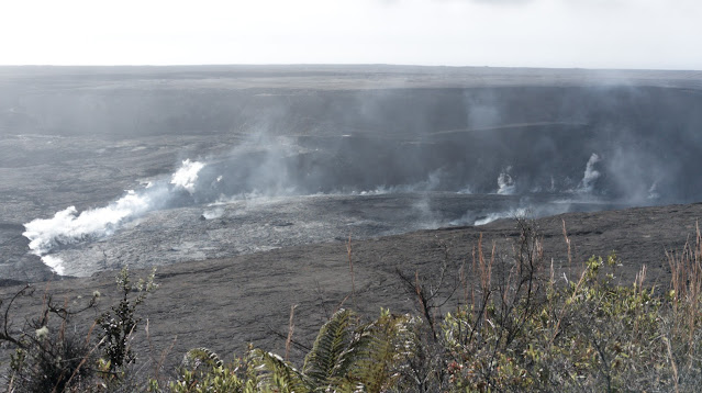
It also deepens (pun not intended) the mystery of the hole's origin. There are plenty of cinder cones on Maunakea, especially around this part of the mountain, which are created from explosive eruptive events (which pulverize rock into cinder), but this isn't a typical cinder cone. Looking at satellite photos, the area nearby seems to show signs of a lava flow, and I've read that some of the last eruptions on Maunakea happened around this general area. Perhaps this particular vent was erupting more fluid lava rather than explosive cinders (which tend to fall back and fill in the vent)? That might explain the strangely smooth-looking floor (rather than a jumble of rocks as might be expected): maybe magma, after erupting, drained back in and we're seeing a frozen lava lake from the last lava to emerge from this vent? The area in the crater seems a bit sharp and jagged to have been erupting pāhoehoe, so perhaps it was ʻaʻā, or perhaps I'm barking up the wrong tree entirely. I'm not a geologist and I have no firm explanation for this unusual feature, I just know that of the many eruptive vents and cones I've seen around the island I don't know of another one like it.

A question answered, more questions raised; so it goes in science, and perhaps it's fitting that the pit retains some of its mystery even after being illuminated by the tropical sun. I've got some thoughts on how I might better estimate the depth of that floor, so look forward to seeing something about that when I find time and motivation to work it out some more. In the meantime, this is getting long so I'll leave it here. A hui hou!

Wednesday, April 26, 2023

Visiting the aftermath of Kīlauea's 2018 eruption

Back on Easter Sunday, I drove about an hour to the south of Hilo to visit the Kapoho area. Specifically, I wanted to see Kapoho crater, which I'd read contained one of the few lakes on the island prior to the 2018 Kīlauea eruption, which filled it in with lava. On the way there, I realized the road I was driving on was built on top of the lava flow from that eruption, which was quite a thrill. It feels like just yesterday I was hearing about it (the year after I left Hawaii for Australia), but of course it's coming up on five years now – just a few days to go.

I didn't manage to get any great photos of Kapoho crater due to scattered clouds coming in and ruining the light, but this panorama from the east side isn't too bad. The lava flowed around and into the crater (leaving a kīpuka) on the side towards the camera. I wish I'd known about (and been able to visit) the lake before it was evaporated away, but I'll have to settle for this. The green of the wooded slopes of the crater walls is certainly quite vibrant against the dark lava surrounding it!

Kapoho crater with its new (solidified) lava lake.
On my way back from the crater, I realized I was passing close to both Puna Geothermal Venture (the sole geothermal power plant on the island) and Fissure 8 itself, the main source of this lava. The lava flowed all around the power plant, covering a few outlying buildings and geothermal wells, but ultimately didn't destroy it. The road leading to it from the highway wasn't so lucky, however, so their new front entrance runs directly across the cooled lava flow that nearly destroyed the plant (as seen in the photo below). Talk about a cool commute to work!

The approach road to Puna Geothermal Venture (to the right). Kapoho crater is (barely) visible in the distance.
Following the lava flow to its source, I found the (in)famous Fissure 8, which erupted in the middle of Leilani Estates, a rural housing development. You can see some of the nearby houses in the photo below, along with a wisp of steam still rising from the general area.

Fissure 8, source of some of the most destructive flows from the 2018 Kīlauea eruption.
I was, as mentioned, living off-island when the eruption happened, and wasn't familiar with the area beforehand, so this was my first time actually seeing the results up close. It's an interesting (and stark) reminder that 90% of Kīlauea's surface area is less than a thousand years old, and that it continues to be one of the worlds's most active volcanoes. Life's never boring living on a volcano in the Pacific! It's nice to be able to explore from a new aerial perspective, as well.

One final photo: a panorama showing Fissure 8 (or ʻAhuʻailāʻau) on the left, the lava flow from it in the middle, and Puna Geothermal all the way over on the right. The sheer scale of the area covered by the flow is awe-inspiring, and flying over it definitely gave me an appreciation for how huge an area was covered.

Fissue 8 (left) and Puna Geothermal (in the distance, right)

And there's still a lot more land area that was covered, and new land that was created! The area's not that hard to reach, so I might head back some time and try to get some more photos of different areas. I've been waiting for the wintry weather here to subside a bit, in hopes of less chance of rain and wind, and it seems like it's finally starting to turn, so I might be able to do some more drone flying before too long. I'd really like to get back up to where the flow from Mauna Loa covered the access road again, this time without the wind nearly knocking me over with each gust. But that's for another post. A hui hou!

Thursday, March 23, 2023

Waiale Falls, near and far

After spending most of February in stormy weather, we finally started seeing the Sun again in Hilo (and glimpses of the copious snow on Maunakea) around the end of the month. Wanting to get out of the house and go flying again after so long not being able to, I took my drone up to Waiale Falls and got there at a fortuitous time to snap the photo below:

There's a lot less water going over the falls than there was in my previous post, but there was still enough to kick up a light mist, which hung in the air around the island and caught the sunlight just right to give the entire scene a slightly mystical atmosphere. It was a bit hazy toward the setting Sun that day (I've no idea how, after how much water had been falling through the atmosphere for the past month), and the whole feeling was one of peace and tranquility after the storm.

I usually take fairly wide-angle, eye-in-the-sky photos with my drone, but this time I decided to do something a little different by taking a closer-in shot of the top of the upper falls. I was pretty impressed with just how much detail it could make out in the water droplets cascading over the edge! And this is despite still being a good safe distance away from any errant mist or spray that might want to jump up and take out a hovering drone nearby.

Waiale Falls makes for a good combination of being visually interesting within a relatively small area, not too far away, and on the edge of town (so fewer people around to make me self-conscious of flying my drone), so it'll probably show up in more photos in time. I'm sure there are still plenty of faces of it left for me to discover! A hui hou!

Tuesday, February 21, 2023

It's not just rivers of *lava* in Hawaii

It's been rainy and overcast most of the past few weeks, but this past weekend especially we've been going through a significant storm here in the islands. Apparently Hilo got over 11 inches/ 26.5 cm of rain on Saturday, and while that was the most in a single day we also got plenty both before and after. It's episodic rather than steady rain, however, so on Monday I took advantage of a break in the rain to see what Waiale Falls looked like with this much water.

The answer turned out to be “phenomenal.” I saw it as I crossed the bridge to park, but the falls' true fury stuck me as I walked back onto the bridge for a better look. A torrent of water poured over the falls, roiling and churning a foamy brown as it passed beneath the bridge under my feet. A ponderous roar filled my ears, and I had to shade my eyes against a cloud of mists fitfully blowing over me from the direction of the falls. It felt like the ground itself was shaking beneath the cascade of water rushing towards the sea (and not just while I was standing on the bridge!).

A shot of two waterfalls as a torrent water passes over them.
Waiale Falls, Wailuku River. A flow rate of ~1000 cubic feet per second.

Quickly moving out of the billowing spray, I got my drone in the air and surveyed the river from above. The sight of the churning waves of water was mesmerizing, but, not knowing how long I had before the rain returned, I took a few photos and got a video flying up the river. A good thing, too, as I can't have been in the air for more than ten minutes before I felt the first drops of returning rain and had to quickly land.

With the footage in hand, I looked back through my files and found a similar video I'd taken all the way back in June when I first got my drone, when the river was running near its lowest ebb. I've wanted to be able to compare the river between low and high flow states for months now, so I put together the following video showing the dramatic difference. The name Wailuku comes from “wai,” meaning “water,” and “luku,” meaning “destruction,” and while you might wonder about the name seeing the river when it's low, this video should amply demonstrate where it comes from.


Anyway, hope you enjoyed the video, and if you get the chance, definitely check out the Wailuku (from a safe distance!) while it's full. It's quite the unforgettable experience. A hui hou!

Sunday, January 29, 2023

Miscellaneous family visit photos (part 2)

Part 2 of the miscellaneous photos series, these will cover more of the geological things we saw and places we visited.

Two days before Mauna Loa awoke from its 38-year slumber, we visited Kīlauea in Volcanoes National Park. While I was there earlier last year, I hadn't actually gone to see the overlook of the (post-2018-eruption) caldera.  It was a pretty spectacular sight, as you could see giant cracks in the ground (visible near center-image below) where huge blocks of material had faulted and collapsed.

Kīlauea caldera. Sorry for the lens flare, the Pixel 7 Pro camera seems a bit prone to it.
The outgassing from around the crater floor that day was also pretty impressive:

Outgassing in Kīlauea caldera.

We also hiked the Kīlauea Iki trail, and I was able to get a nice photo back across the crater floor with hardly any people in it:

Kīlauea Iki crater floor.

I don't have too much to say about these photos since they're generally places I've seen and posted about before. We also visited Akaka Falls (for the first time since I got back), which was as impressive as always:

Akaka Falls.
It's still amazing to think about those fish (the ʻoʻopu) that are born above the falls, plunge down on their way to the ocean, then return and climb up the waterfall (along the rocks with suction cups) to breed. ʻOʻopu are hardcore. (For reference, Akaka Falls is 135 m high, and there are ʻoʻopu found at the top of 300 m high waterfalls elsewhere on the Hāmākua coast.)

Finally, stretching the definition of the post title slightly, here's a drone photo from November 29th, the day my family flew out and I went up to try to see Mauna Loa's eruption. This was taken when I flew out towards the lava, as in my video from last month. I couldn't see the lava very well on my controller screen so I didn't bother taking many photos, but in hindsight this is still a fairly cool photo and I should probably learn it's better to take a bunch of low-quality photos than to miss out on a potentially amazing one.

Lava rivers running down Mauna Loa's flank, November 29, 2022.

There may be one more post in this series with a few more photos, which will at least involve something new that I'd never done before. A hui hou!

Wednesday, January 11, 2023

A (belated) Christmas (Eve) crater

Last year on Christmas Eve I took a trip up Maunakea to check out something new. Well, “new” in the grand scheme of things; I wanted to see a young pit crater which appeared high on the flanks of Maunakea…back in 2015. I first heard about it the week before, however, and decided to check it out for myself since it's actually fairly substantial, perhaps about 40 m/150 ft across. It's also pretty high up, at around the 10,000 ft/3,000 m level, a bit higher than the Visitor Information Station. It's also in a region not open to hiking, so I had to get a little creative by flying my drone up the mountain side from a place where I could hike.

Anyway, here it is, the newest geological feature on Maunakea that I know of. In case you're wondering, this is not an eruptive crater; it's actually a collapse crater. From what I've heard, this could come about from an old, empty space (left over when magma drained away from past eruptions) slowly migrating upwards via successive ceiling collapse until it reached the surface, almost like a bubble moving upwards through liquid.

I was able to fly directly over and look down, and it's possible to make out the bottom, faintly. From looking at it while flying around I estimate it's maybe a bit deeper than it is wide (though it seems to widen out slightly below ground, possibly). In this photo you can better see that there's a fence around it, so clearly it's been known for a while and I'm late to the event, but I still think it's pretty cool to get to see something like this that's still so relatively new.

As an aside, reaching this by drone was an interesting experience. Drone regulations only allow flying up to 120 m/400 ft above ground level, but since this was up the side of the mountain I actually flew up to 500 m above my position vertically (the maximum permitted elevation of the DJI Mini 3 Pro) while flying up the slope. Luckily, that turned out be just high enough to reach the crater and get these photos, which were taken pretty close to that limit. It would've been cool to get a bit closer, but because I was flying from down on the ground I had to stay pretty high in the air or an intervening puʻu would block my signal (not just theoretically, I started losing signal strength several times during the flight by going too low).

I'll leave you with one more photo I took when I turned my drone around to fly back: the clouds were coming in at just that elevation, which is probably not a sight a lot of drone pilots get to see. Overall it was a fun experience, and a great demonstration of one of the reasons I wanted to get a drone: to better show off the amazing environment of this island by getting photos I otherwise couldn't. And should I hear of any other new (accessible) geologic features forming, I'll try to check them out as well*! A hui hou!

*The recent lava flow from Mauna Loa is still a bit too far away from open roads, unfortunately, I tried for that the day after Christmas. I did see in a news article that they're hoping to re-open the Mauna Loa Access Road in a few months once the lava covering it cools and they can re-build the road to the observatories.

Sunday, December 25, 2022

A Christmas volcano visit for 2022

Merry Christmas everyone! I finally got around to editing together a video from drone footage I got back on November 29 when I went up to see Mauna Loa's eruption on its second full day. I flew from Puʻu Huluhulu out towards where the lava was flowing, but it was still so far away at that point that even at the limit of my signal range it didn't look all that impressive on my controller screen. Which is a shame, because it meant I didn't bother taking that much video at the closest point, whereas it actually looks fairly neat when blown up to a larger size; a good lesson to learn for the future, I suppose.

One other very cool event occurred along the way, however, which I really wanted to include in a video and is a good part of why I eventually made this one. I left the camera recording while flying out toward the lava flow, and perhaps halfway there a flock of birds appeared out of nowhere, flying and diving around and in front of my drone. I almost had a heart attack as my first thought was that they they might attack the drone, but they simply flew along with it for around half a minute before diving out of sight. I'm not sure why they decided to fly along, as I was deliberately flying nearly at my height ceiling to avoid disturbing any wildlife that might be on the ground; maybe they were just passing by and decided to follow along for fun? You can watch the video and judge for yourself:

Just to be clear, while a no-fly zone was put in place over the eruption area the next day, to the best of my knowledge this was still an acceptable flight when I did it. It's a bit disappointing to me that there wasn't any flying allowed for the rest of the eruption, but I guess the lesson to be learned is to jump on the next one quickly. Anyway, that's my Christmas present to all of you this year. I may have some more mauna*-related drone photos/videos in the not-too-distant future, but we'll see how things play out. Mele Kalikimaka, a hui hou!

*Loa and kea.

Wednesday, November 23, 2022

Waiale Falls and surrounds

One fun side effect of getting a drone and wanting simply to get out and fly with it in the beginning has been exploring and finding places relatively nearby that I hadn't been to or didn't know about before. One such place is Waiale Falls on the Wailuku River, just on the outskirts of Hilo. There's a bridge which crosses the river just below the falls, offering a nice vantage point, and it's actually more than just a single waterfall, as the topography makes for some interesting and complicated confluences and meanderings of waterways. Since it's only about 10 minutes from my house (while offering some relative solitude for practicing drone pilots), I've gone there a number of times both to take photos and practice my flying.

There are actually two main waterfalls in quick succession along the Wailuku river, two streams which join with it in the space of a few dozen meters, and an area where water splits off above the top waterfall only to meander around and join with the river again. In the image from Google Maps below, the road (Waiānuenue Avenue) crosses the Wailuku near the center-bottom of the image. To its left you can see the lower falls, then there's an island in the river and the upper falls, plus the Kapehu and Nakakauila Streams which join the river.

However, while the overhead view is useful if you know what you're looking at, a nice drone shot can be a lot more immediately understandable:

Here's a shot of the same area (looking roughly south-west), though with the lower falls hidden behind trees. It's hard to see, but the area where the cars are parked in the center is actually an island itself, as a stream splits off from just above the upper falls and meander down around below the bridge in the foreground, only to join the river again below the bridge below the lower falls. It's tricky to see because of trees, but here's a shot showing the area around the upper falls:

Despite what it might look like, the two pools of water here are not connected: there's a spur of rock that separates them (behind the foreground tree), letting the waters of the main river continue on the left while splitting those on the right off to meander around before rejoining the river. It's a really interesting formation and one that I suspect isn't particularly common!

Here's a shot showing the two falls and the area between them with a sort of gravel-bar island a bit better (the bridge is just out of shot to the bottom):

The lower fall clearly has some man-made construction going on, though I don't know the details. Incidentally, the name Waiale comes from the words wai and ʻale, meaning “rippling water,” so I suspect the pond's been there since before anything was done to the lower fall. There are some (rough, unnofficial) trails in the area which let you walk up to that area, and I've seen people swimming around the island. When the river's low like in the photos it's probably not too bad, but the Wailuku is the single most dangerous river in the state, responsible for something like 30% of river drowning deaths annually, so I wouldn't exactly advise it unless you really know what you're doing. When it rains the water flow of the river can increase by something like a hundred times over what it looks like in these photos in a very short span of time, so you definitely don't want to get caught in a flash flood. (In fact, the name of the river, Wailuku, translates roughly to “waters of destruction.”)

Here's one final photo of the lower falls, taken from below the level of the bridge just above the water to give a perspective on its power even in its relatively low-flow state:

(These photos were taken on different days, which is why the lighting conditions differ so much between them.) All in all, I enjoy this area (which I hadn't visited prior to June), and it makes a conveniently-nearby place to go relax and fly after work if I want something more interesting than houses in Hilo to look at. It's started raining more again lately as we come into the wet season here, so I'm hoping to catch it soon in a higher-flow state to compare with these photos. I might even put together a video if I can get enough good clips.

On a related note, my family will be visiting for a week over Thanksgiving and I'm looking forward to getting photos of the various places we visit, so I'll probably have a raft of new exciting photos to share before long. It'll probably take a bit of time to sort through everything and post them, but I should have some great new stuff to share in the not-too-distant future. In the meantime, happy Thanksgiving! A hui hou!