Showing posts with label geology. Show all posts

Sunday, July 30, 2023

Drones, geology, and the tropical sun: a case study

On the slopes of Maunakea, a short distance east of the Visitor Information Station and Hale Pōhaku, a small pit crater (sometimes evocatively called “Bottomless Pit”) can be seen on satellite imagery.

I've circled it in this wider view of the area, it's not very big.
I thought for sure I'd mentioned it before on this blog, but a search failed to turn up anything. I find myself surprised at this, because I've been aware of this crater for over a decade now, and I've wondered how deep it goes for nearly as long.

You see, this crater is a bit unusual. There are many puʻu, or cinder cones, on Maunakea, and plenty of eruptive vents on Mauna Loa and Kīlauea. But from the ones I've seen up close, such eruptive vents are always filled in pretty close to the surface with hardened lava or choked with tumbled stone. This pit crater is unusual because, alone of all the craters I've seen on this island in Google Maps (and I've spent many hours looking), it has a dark hole at its center.

A closer view of the crater, with the hole clearly visible.
My first encounter with this crater actually came all the way back in 2012, which is how I know I must've discovered it within a few years of moving to the island. I don't remember the exact date, other than that it was on (or very close to) the night of a full Moon, and (for a few reasons) probably sometime during the summer.

I was working at the Visitor Information Station in 2012, and sometimes I'd have multi-day shifts, where I'd stay overnight in one of the rooms at Hale Pōhaku. I think I must've recently discovered the crater at the time, as I was very interested in hiking out to see it. I didn't have a car at the time, so while I could ride up to the VIS for work, I didn't have time during the day in which to visit the crater. (This recent discovery/fixation may help explain what follows.)

I'd just finished a day of work and gotten back to my room at around 11 PM, when I was struck with a crazy idea: why not hike the roughly half-mile distance out to see the crater? It was a full Moon, and there was plenty of light. (There were some light clouds steadily blowing west overhead, but not enough to seriously dim the moonlight.)  To my early 20s brain this made perfect sense; I was in pretty good shape, and could still miss an hour of sleep without feeling it too harshly the next day, so without telling anyone I was going for a nocturnal jaunt I grabbed my trusty headlamp and set off to the east.

In retrospect of course, going for a high-altitude hike at night to a geologic feature of unknown depth without telling anyone has Not A Good Idea written all over it. As mentioned, I think this must've been during the summer, as I remember the night being relatively mild, but it still wouldn't have been very fun to have been caught out overnight if I'd, say, sprained an ankle. And one thing I didn't know before setting out is that the ground between Hale Pōhaku and the crater is some of the best terrain I've ever seen for twisting an ankle, being mostly loose soil with fist-sized rocks that turn over at the touch of a feather (or at least a hiking boot).

Still, after half an hour or so of trudging over hill and dale (there's a ridge between Hale Pōhaku and the crater which isn't apparent on the map), I made it to my target, approaching from uphill (the northern side). As I crested the rim of the crater, I had an impression of it lying sprawled before and below me, and in its center, a yawning maw of inky blackness large enough to swallow a person. The full Moon overhead, the patchy clouds, the just-completed trek through silent shadowy solitary surroundings, and the anticipation I had for the event all combined to engender a feeling of solemn awe and make it a momentous, even portentous event.

I felt this feeling of awe for perhaps a full second, maybe even two, when a bird suddenly exploded out from where it was nesting not far from where I stood in a loud whirring of wings and squawk of alarm, giving me the fright of my life and nearly startling me over the edge of the crater as I reflexively jerked around.

I managed to retain my balance and not fall into the crater (thankfully, as will become apparent). I think, after recovering from the fright that hapless avian denizen gave me, I tried to take a few photos, but the light wasn't enough for them to come out. To make a long story short, after some more minutes admiring the awe-inspiring nighttime scene I headed back to bed with no one the wiser about my ill-advised midnight perambulation. And that was actually the last time I visited the crater for a full decade.

But even apart from it, all those years, I continued to wonder: just how deep did that pit go, which had left such an indelible impression upon my younger self? In those intervening years, I moved to Australia, got a PhD, and moved back to the island, and in between something new entered the pictures: drones.

While consumer-facing drones have been around since well before I moved to Australia in 2017, early models were cruder and less functional than the ones available today, and I wasn't really aware of their slowly improving capabilities. My vague impression was that they were mildly interesting toys, but not much more. (I also didn't exactly have the disposable income to buy one at the time, so I wasn't paying much attention.) Regardless of how accurate my assessment was at the time, it's true that drones have only continued to improve since, and in mid-2020, while stuck at home in lockdown in Melbourne, I started coming across videos on YouTube that opened my eyes to just what modern drones could do.

Enter another piece of information: Hawaii's location in the tropics. This fact means that, twice a year as the Earth progresses along its orbit, the Sun passes directly overhead. I don't remember when I first put two and two together, but at some point I had the thought that, at just the right time, the Sun would be directly overhead, casting its rays down the mouth of the pit…and that if I were to, say, be flying a drone over it at that time I could get an idea of just how deep the rabbit hole pit crater went.

Lāhaina noon (the modern name for when the Sun passes overhead) happens in May and July for Hawaiʻi island. (It happened last week, July 24th, in Hilo.) Last year I was excited to get my Mini 3 Pro in June, in time to catch the Sun in July. I even hiked out to the crater for the first time in a decade the week before Lāhaina noon to scope the area out, only to fall sick that week and be unable to head up Maunakea on the day itself. Still, I wasn't discouraged, and philosophically reasoned that a year's experience with drone flying would help me next time around. This year the May Lāhaina noon happened in the middle of the week, but the July one happened over the weekend of the 22nd/23rd, so I possessed my soul in patience and bided my time. I did get some pictures, though:

The crater July 2022, with the pit in the middle. A bit less spooky under the summer Sun.
This past Saturday, July 22nd, my chance had finally come: I headed up Maunakea with my Mini 3 Pro (and a friend), hiked out along a trail downhill from the crater, and as the Sun reached the zenith, I sent my drone skimming through the air towards the pit.

The crater July 2023, from the air. The hole's a bit bigger than a person, for scale.
And after a decade of wondering about this particularly intriguing geologic formation, I finally had my first glimpse at an answer regarding its depth! Everything, to my surprise, worked out perfectly: the Sun blazed away overhead, its light illuminating the pit, and to my surprise (and delight), it turned out to be significantly deeper than I'd been expecting.

Behold, the pit crater's floor, clearly visible.
A decade of wondering, years of imagining how this moment would go, and I can still hardly believe it went off without a hitch: I was able to clearly see and photograph the floor of the pit. A still photo doesn't show the parallax I saw while flying over it, but from that I would estimate that the bottom of that pit has to be on the order of 10 meters (~30 feet) down, or perhaps more. I took some videos of the effect, and I hope to make a slightly more rigorous estimate before too long, but I wanted to share this photo soon after fulfilling a multi-year dream of mine. (Yes, some people's dreams are inspiring stories of overcoming hardship or taking years to achieve something significant; mine pretty much boils down to, “I wonder how deep this hole goes?”)

It also deepens (pun not intended) the mystery of the hole's origin. There are plenty of cinder cones on Maunakea, especially around this part of the mountain, which are created from explosive eruptive events (which pulverize rock into cinder), but this isn't a typical cinder cone. Looking at satellite photos, the area nearby seems to show signs of a lava flow, and I've read that some of the last eruptions on Maunakea happened around this general area. Perhaps this particular vent was erupting more fluid lava rather than explosive cinders (which tend to fall back and fill in the vent)? That might explain the strangely smooth-looking floor (rather than a jumble of rocks as might be expected): maybe magma, after erupting, drained back in and we're seeing a frozen lava lake from the last lava to emerge from this vent? The area in the crater seems a bit sharp and jagged to have been erupting pāhoehoe, so perhaps it was ʻaʻā, or perhaps I'm barking up the wrong tree entirely. I'm not a geologist and I have no firm explanation for this unusual feature, I just know that of the many eruptive vents and cones I've seen around the island I don't know of another one like it.

A question answered, more questions raised; so it goes in science, and perhaps it's fitting that the pit retains some of its mystery even after being illuminated by the tropical sun. I've got some thoughts on how I might better estimate the depth of that floor, so look forward to seeing something about that when I find time and motivation to work it out some more. In the meantime, this is getting long so I'll leave it here. A hui hou!

Sunday, March 27, 2016

(Historic) Eruptive Action at Puʻu Huluhulu

Last week some friends from work and I went for a hike up on Mauna Kea near the Visitor Information Station. On our way down we stopped at Puʻu Huluhulu (which I've written about before) for a short hike since one of my friends hadn't been there before.

I wasn't originally planning to take any pictures, but as we were rounding the western end I was struck by something I hadn't noticed before. Move your mouse over the picture below to see it highlighted! (Which effect, incidentally, is a new trick I worked out just for this post. Mobile users, I'm not sure how mouseover effects are emulated, I'm afraid…try long-pressing on the image, perhaps?)

Western end of Puʻu Huluhulu, just off Saddle Road.

What I noticed, which can be seen better in the close up images below, is that at both sides on this end of the hill are pieces of flat rock sticking upwards at an angle. Given how they flank an eruptive cinder cone, I'm drawn to the conclusion that these are pieces of the overlying lava flow through which Puʻu Huluhulu erupted. (I keep wanting to call them the “crust” since they're both pretty thin—a few inches thick at most, especially the one on the right.) Presumably the rock connecting them was pulverized or ejected in the eruption of Puʻu Huluhulu and these pieces were far enough from the center to remain where they ended up.

Close-ups of the two bits of up-thrust crust.

Two miscellaneous comments on the first photo:
  1. That sky is surprisingly blue. We actually came down from Mauna Kea a little early because the weather was threatening rain, and there were a lot of patchy clouds and patches of fog on the way down. The wind was blowing pretty hard, and there were a lot of tiny water droplets in the air, so it surprises me there's that much blue sky to be seen.
  2. That picture also happens to be a (cropped) panorama I took with my phone. As someone who's put together a fair few panoramas by hand I remember being a bit disappointed in my previous attempts to use the auto-panorama feature in my camera software. I only took this one as something of an experiment, but perhaps the camera software was updated when my phone upgraded to Android 5.1 or something, because I'm actually pretty impressed with the result (I even have a slightly-differently cropped version as my desktop background right now). I'm looking forward to using this more in the future; as should be apparent from this blog I love panoramas, but putting them together is a bit time-consuming so hopefully this'll allow me to take more of them in the future.
Anyway, I thought this was kind of interesting as I didn't notice those bits of crust the last time I was there. A hui hou!


Friday, September 20, 2013

Terra Nova Cognita

Planet Earth never ceases to surprise us. Within the past month we've discovered a canyon and a volcano, both of which are longer and larger than the previous record-holders in those categories.

The first record-breaker, known as the Greenland Grand Canyon, remained unknown until last month because it lies beneath Greenland's ice cap. It was discovered using ice-penetrating radar and is over 750 kilometers (466 miles) long, a bit less than twice the length of the Grand Canyon in Arizona (at 446 kilometers [277 miles] long. It's also up to 800 meters (2,600 feet) deep, and up to 10 kilometers (6 miles) wide. (Though Arizona's Grand Canyon is both deeper and wider in places.)

(The longest canyon in the world is actually the Yarlung Tsangpo Grand Canyon in Tibet, which is a bit longer than the Grand Canyon in Arizona, although I couldn't find solid numbers on how much longer. It is also the worlds deepest canyon, with a deepest point of 6,009 meters [19,714 feet].)

The second record-breaker is a volcano located on the Pacific sea floor about one-third of the way from Japan to Hawai'i. This humongous edifice goes by the name of Tamu Massif, and while it has been known since at least 1993, it was previously thought to be multiple volcanoes due to its incredible size. On it September 5th it was announced by scientists studying it that it was actually a single volcano, which made it the largest volcano on earth.

This announcement was of interest to me, since I live on the flank of what was previously thought to be the largest volcano in the world – Mauna Loa. When we say “largest,” we should be sure to define what we mean. Tamu Massif is larger in surface area than Mauna Loa, but shorter in height. Mauna Loa has a surface area of 5,000 square kilometers (about 1,900 square miles), and rises an incredible 9,170 meters from the sea floor (30,085 feet). Tamu Massif, by contrast, rises a mere 4,460 meters (14,620 feet) from the sea floor, but has a surface area of 260,000 square kilometers (100,000 square miles), approximately the size of New Mexico.

Despite its height, the summit of Tamu Massif is still 1,980 meters (6,500 feet) below the surface of the Pacific Ocean. This is because it has an incredibly gentle slope (it's also long extinct, so it's not getting any higher). Mauna Loa has slopes that don't exceed an average inclination of 12 degrees, but Tamus Massif's sides have an average inclination of no more than a single degree.

Tamu Massif has some interesting similarities with a volcano on Mars called Alba Mons. Since “Everything's Bigger on Mars” when it comes to geological features, it's no surprise that Alba Mons is larger than Tamu Massif. In terms of surface area it stretches for a good 1,000 by 1,500 kilometers (620 by 930 miles). Like Tamu Massif, it too has incredibly gentle slopes of 0.5 degrees on average.

It's not surprising that these incredible features of our world could remain hidden for so long, given their locations under ice cap and ocean. It's definitely exciting that we're starting to discover them. Who knows what else there is out there waiting to be discovered? A hui hou!

Tuesday, July 30, 2013

Science Clock Series: Part VII

Today's number comes from geology, and is given by:


\[\text{Quartz (Mohs scale, SiO}_2)\] The Mohs scale of mineral hardness is a scale developed by the German geologist Friedrich Mohs in 1812 to help classify minerals based their relative hardness. Its purpose is to show which minerals can scratch other minerals, and it doesn't represent the absolute hardness difference between them. (There are ten levels on the Mohs scale, but the absolute hardness difference between level one and level ten is a factor of 1600.) For any mineral, it can (in theory) be scratched by anything higher on the scale than it, and can scratch anything lower on the scale than itself.

There are ten levels on the Mohs scale, defined by ten specific minerals. The ten levels of the Mohs scale are defined by:
\begin{align}1&\dots\dots \text{Talc}\\
2&\dots\dots \text{Gypsum}\\
3&\dots\dots \text{Calcite}\\
4&\dots\dots \text{Fluorite}\\
5&\dots\dots \text{Apatite}\\
6&\dots\dots \text{Orthoclase Feldspar}\\
7&\dots\dots \text{Quartz}\\
8&\dots\dots \text{Topaz}\\
9&\dots\dots \text{Corundum}\\
10&\dots\dots \text{Diamond}
\end{align}As you can see, the hardness of quartz is the definition of hardness level 7 on the Mohs scale. For comparison, your fingernails have a hardness of about 2.2–2.5 on the Mohs scale, a copper penny is about 3.2–3.5, a pocket knife is about 5.1–5.5, and a steel file about 6.5.

As an interesting aside, the enamel your teeth are made of is basically a variant of apatite (called hydroxyapatite) which, as you can see, is the definition of hardness level 5. This suggests that you probably don't want to be scratching your teeth with anything higher on the scale than a 5. (Tooth enamel also happens to be the hardest substance in the human body, in case you were wondering.)

Quartz itself is an interesting mineral. It's the second most abundant mineral in the Earth's continental crust after feldspar, and has been used in jewelry and handicrafts throughout history. It is made up of silicon dioxide (also known as silica) with the chemical formula \(\text{SiO}_2\). Silica can solidify in many different arrangements, or even mixtures of them in an amorphous structure; two of these arrangements are known as \(\alpha\)- and \(\beta\)-quartz.

Quartz/silica is a pretty tough material and is relatively resistant to erosion (it's number 7 on the scale after all). Being the second most common mineral in the Earth's crust, silica shows up in many places. Most sand in inland deserts is made up of tiny particles of silica, and the type of glass used to make up windows and drinking glasses for the last few centuries (soda-lime glass) is composed of about 75% silica. Many marine organisms construct skeletons or homes for themselves out of it (sponges and diatoms [single-celled plankton] in particular). Silica even has a slight connection with our number 4: it is used to help extract DNA due to its ability to bind to it.

Anyway, check back next time for a look at another number from astronomy! Click here to jump directly to it.

Tuesday, April 9, 2013

Spelunking Emesine Cave, Part 1

About two weeks ago on Good Friday I organized an excursion with some friends to explore Emesine Cave, a lava tube high on the flank of Mauna Loa created in the 1880-1881 eruption that came perilously close to destroying Hilo. It exists as several disconnected sections totaling over ten miles in length, making it the fourth-longest lava tube in the world as of right now.  However, the section we explored at about 2,300 meters (5,700 feet) elevation was only about a mile in length.

I took quite a few pictures this trip, so much so in fact that after looking through them I've decided to split this post into multiple parts.

Unlike the Kaumana Caves county park where the entrance is just a few dozen feet from the parking lot, the entrance to Emesine Cave is found only after a 2.6 mile hike at nearly 6,000 feet. For being so high, the lower air pressure didn't really bother anyone as I was afraid it might. WolframAlpha suggests the pressure would be about 812 millibars, which is close to 80% of sea-level pressure, so I guess it wasn't really that bad. Hindsight, and all that.

The hike was pleasant, following the remains of a straight road that remained mostly flat or only slightly inclined along its length. We passed through several stands of older forest among the more barren and recent lava plains. Hawaiian has a word for these islands of older forest surrounded by newer flows of lava: kīpuka. These particular kīpuka are great habitats for some of the endemic Hawaiian birds, and it was really lovely to get out of the constant background noise of Hilo and hear some actual birdsong again. We didn't see many birds, but the sound of their song was a constant background for us along our trek.

Here's a panorama I took with my phone. I think it does a good job of capturing the feeling of the vast lava plains we were traversing.


Unfortunately you can't really see much in it, other than the dark surface of the lava in the shadow of all those fluffy clouds. If you click on it to blow it up, you can see the base of Mauna Kea off to the left.


Along the way I had some of these pointed out to me. They're called ʻŌhelo berries, or Vaccinium reticulatum. They're actually edible (and related to cranberries), so I ate a few. They grow wild at altitudes between 640–3,700 m (2,100–12,100 ft) in the rich volcanic soil, and are a popular ingredient in home-made jams and jellies in Hawai‘i, in the same way wild raspberries or blackberries might be on the mainland. The ones I consumed mostly didn't have much taste, but some of them were moderately sweet. The color doesn't necessarily indicate ripeness, I later learned.

When we finally got to the entrance, we found a large skylight perhaps thirty to forty feet across and about twenty feet deep that provided entrance to the tube. Unlike Kaumana Caves, there were no easy-access steps-with-accompanying-handrail going down into this one, so we had to clamber down the jumble of collapsed rock inside that fortunately came up close enough to the edge on one side to permit entry.

Entrance to Emesine Cave.

Since the guidebook I'd read said that the uphill side of this section was fairly uninteresting, we headed downhill.

There are a lot of interesting features in Emesine Cave. It's also an easier walk nearly its entire length than much of Kaumana Caves, which was nice. Most of the floor is easily-traversable cauliflower ʻaʻā, with little of the collapsed rock from the roof that makes Kaumana Caves so difficult to explore in places. Emesine Cave also tends to have a flatter grade than Kaumana; up this high on the flank of Mauna Loa the lava was flowing nearly horizontally and traveled for great distances in fairly uniform conditions without losing much heat. Contrast that with Kaumana Caves, near the end of the flow, where the terrain was rougher and the flow more intermittent, producing a huge diversity of features that change rapidly on short distance scales.

Anyway, enough talk, you want pictures!


One thing that never gets old in lava tubes is the amazing variety of colors. This photo was taken near the entrance, so I think the green is some kind of photosynthesizing-life, but it might also be olivine. And the white may be gypsum that crystallized out as the lava cooled.


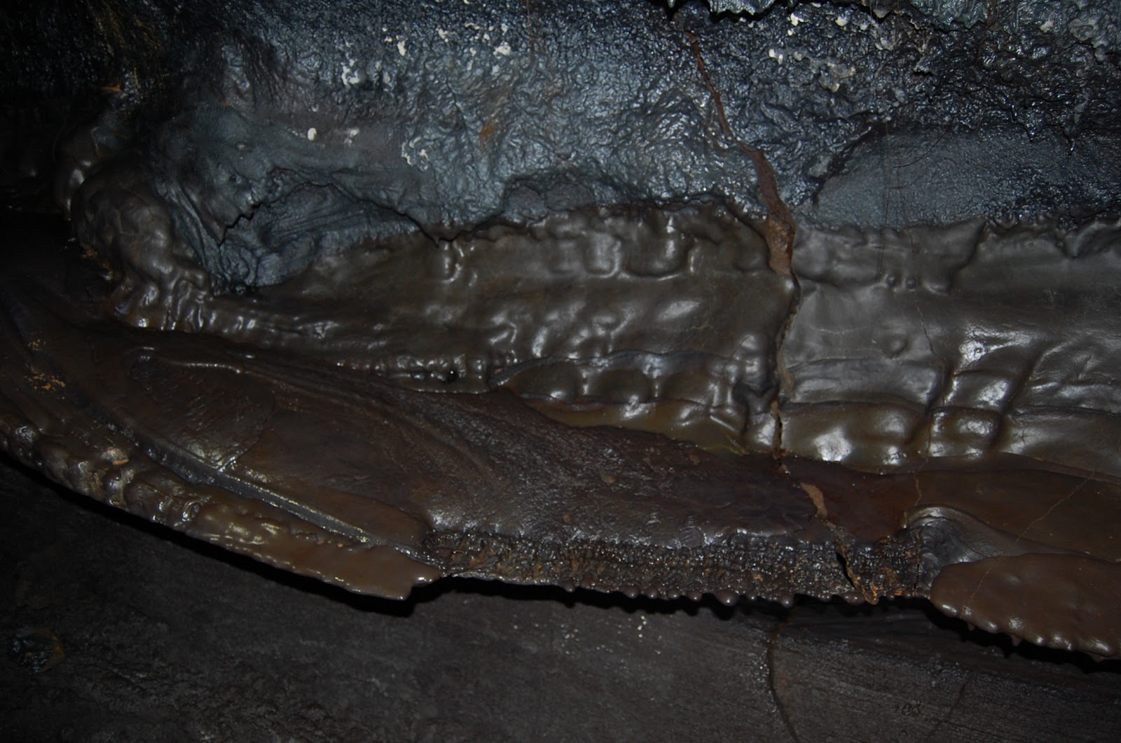
This is a ledge extending out from the wall, showing where a tube-in-tube formation might have formed if the lava level had held steady.


Close-up of the previous picture. The saw-tooth structure is amazing, I've never seen anything like it before in a lava tube. Reminds me of a fish fin.


I love the whorls and contrast in this picture. It just doesn't look like solid rock, does it?


There are some massive formations of these kinds of lava-cicles in Emesine Cave. Near the top of the picture just left of center you can see some that appear to come in ridges, which may have something to do with how air was flowing through the tube when they formed.


As you approach the first (and only) skylight in Emesine cave, the tube splits just before the opening, giving you two exits. This is the right one, which is traversable (I tried it coming back), but not comfortably (I had to hunker down and waddle through for about twenty feet).


The left side is easily walked at full height, even for me. (Ignore the roots in the foreground, they're hard to see in the dim light of your flashlight and it isn't until you get home and look at your pictures that you realize just how much light they reflect and how badly they interfere with your photos.)

Anyway, I think I'll end it here for now. Look out for the next part to come soon!

Wednesday, April 18, 2012

Climbing Mauna Loa

Last week I had the amazing opportunity to hike the summit of Mauna Loa with a few friends.

Mauna Loa, if you don't know, is the largest volcano on Earth, and second in the Solar System only to Olympus Mons on Mars. It is estimated to have a volume of 18,000 cubic miles of rock (75,000 km³), that is, 375 times the size of Mount Hood, enough to fill the Grand Canyon 18 times over, and more than the entire Sierra Nevada range. It achieves this great volume by being not only incredibly tall (almost 56,000 feet [17 km] from the ocean floor), but incredibly flat. The overall slope of the mountain doesn't exceed 12°, which, despite its great height, makes it rather hard to see when you're directly on it. From Hilo, Mauna Loa just looks like a big hill, while Mauna Kea (which is only 120 feet [36 m] taller than it) looks like a looming mountain. The name Mauna Loa means “Long Mountain” in Hawaiian, and as I quickly discovered, it could not be more appropriate.

We got out of Hilo a bit late, and the fact that the road from the Saddle road up to the Mauna Loa Observatories is a big pot-hole-y mess meant we didn't arrive at the 11,000 foot mark until 8:40 AM, at which point we left the car and began hiking [edit from the future: how funny that by 2017 the road would be entirely paved, and an easier drive than Mauna Kea]. Now, being the over-prepared nerd that I am I had taken the opportunity beforehand to thoroughly inspect our route on Google Earth, so that I would have at the very least a mental map in case I couldn't get reception, or the weather suddenly turned nasty and we couldn't navigate. The smooth slope of Mauna Loa actually makes it somewhat difficult to determine which way is mauka (uphill, away from the sea) or makai (downhill, seaward) in places.

Anyway, on Google Earth there was a very clearly defined route traveling up the mountain via several switch backs that petered out just below the rim of North Pit, a small secondary crater on the edge of the summit caldera, which is named Mokuʻāweoweo.  (Mokuʻāweoweo is an absolutely huge crater, 1.5 miles wide and 3 miles long. North Pit is small only in comparison, and is probably a mile in diameter.) I naturally assumed that this was the “6 mile trail” mentioned on several websites, and that it would be a fairly simple matter to just walk up the nice, gentle slope of Mauna Loa's flank.

Since no one else was showing any signs of navigation, I assumed the position (aided by the fact that I had excellent reception [and access to Google Maps] the entire way up) and bravely led the group up the fork of the trail that led up the mountain, rather than the mysterious fork that appeared to continue on around the mountain. Or, rather, I pointed the way out to the group and huffed and puffed along behind them in the thin atmosphere. Along the way I turned around long enough to snap the following picture of Mauna Loa in the early morning light:

Mauna Kea in all its glory. So pretty...
In the slightly zoomed-in image below, you can make out several observatories on the summit (I see the James Clerk Maxwell Telescope, Subaru, the Caltech Sub-millimeter Observatory, Keck I & II, the Canada-France-Hawaii Telescope, Gemini North, and the UH 88-inch telescope) and can even spot the limits of Mauna Kea's glaciers as a fairly distinct line encircling the mountain about a third of the way down from the summit.

Observatories on Mauna Kea, and the line marking the extent of glaciation.
Breathing at altitude is funny stuff. The slightest exertion leaves you breathing heavily, and heavy exertion has you gasping. By the end of the day I was beginning to worry I'd cracked every rib in my body from the force of my breathing alone. (Thankfully, that healed up in about two day. But boy, when it hurts to breathe, every day seems like an eternity.)

Anyway, we continued on our merry oxygen-deprived way for an hour. Then two. Then another. And another. Finally, after five hours of almost non-stop walking, at long last we we reached the edge of North Pit. Oh, and did I mention that the clouds came in and started dropping sleet on us (yes, sleet) about noon?

Trying to get out of the constant light sleet I clamored down the edge of North Pit, found a slight outcropping of the crater rim, and proceeded to eat the small lunch I had brought with me. It was quite exciting to be sitting on the frozen surface of a vast lava sea, knowing that the volcano had been active a mere twenty-eight years earlier, and that a vast magma chamber lurked only a little less than two miles below my feet. I was able to put together the following panorama while I was sitting there.
Edit (3/17/18): I redid the panorama using Hugin, but you can still see the original by mousing over the image.


This picture was taken in a rare five-minute period when the sun broke through the clouds. Off in the distance, just below the far wall of North Pit you can see steam rising from the floor of the crater. (Probably from rain landing on rocks heated by the sun I hasten to add, not because they were being heated by magma underneath!) Further off you can see through the break in the wall of Mokuʻāweoweo, and even see the highest part of the crater rim near the center of the image.

By this time, it was already 2 in the afternoon, the sleet was switching to rain and back again and showing no signs of letting up, and we still had to walk down, so after eating a woefully late lunch we started the trek back down. I was happy when we got low enough for the sleet to stop, until it was replaced by rain. That morning I had made the decision to wear my (lighter, non-water-proof) fleece in favor of my (heavier, water-proof) coat, so everything I had very slowly began to moisten as we walked down. That actually turned out to be a blessing in disguise, because my damp clothes kept me from overheating and kept my body temperature just about perfect the entire way down. Thankfully the rain never got heavier than a light drizzle.

Three hours after we left the summit we finally staggered back to car, whereupon we had another hour-and-a-half drive back to civilization. I haven't heard of any lasting injuries, but we were all stiff and sore for the next few days.

Mauna Loa is an absolutely fascinating mountain, especially when you compare it with its near sibling Mauna Kea. The lava on Mauna Loa is obviously much newer and fresher than on Mauna Kea, where most lava flows have been covered by either cinder, glacial deposits, or vegetation. (There are some places near Mauna Kea's summit where you can see the exposed flows, usually deeply scarred from the glaciers they erupted under.) On Mauna Loa, lava flows stand out stark and fresh. They also weather to a different color; while old lava on Mauna Kea oxidizes to a reddish-brown color, Mauna Loa's lava goes more for a straight brown. It's very neat to be driving through a patch of black lava, probably less than a hundred years old, and come across a small kīpuka of much older brown lava that didn't get covered in the middle of it. There is a lot of older lava on Mauna Loa (take a look at the picture below for some) and it's fascinating to think about what Mauna Kea must have looked like before it began its post-shield phase and covered everything with a layer of cinder. Alternatively, it's really cool to imagine Mauna Loa after it enters its post-shield phase and starts erupting cinder and cinder cones all over.

A fairly old lava flow on Mauna Loa's flank.
Note how the lava is starting to crumble and flake off.
All in all it was an incredible experience, though one I am in no hurry to replicate. In fact, after we got back and started mentioning it to others more familiar with the mountain, it turned out that we had missed the actual trail and taken the vehicle trail. (Turns out it was that mysterious fork after all.) So instead of a 12.2 mile round trip, it was probably more like 15-20. Because it took us so long to reach the summit we were in no position to actually explore or look around, so we didn't make it to either the true summit on the west side of the crater or the location of the historic Wilkes Expedition campsite on the east side. (The Wilkes Expedition was part of the U.S. Exploring Expedition to the Pacific, a push by the young United States to explore the Pacific for scientific and commercial reasons that lasted from 1838 to 1842. Fun fact: the site of Wilkes' campsite on the rim of Mokuʻāweoweo is the only physical evidence in the Pacific that remains of the entire expedition.)

Now that I know where the trail really is, I wouldn't mind going back some day (hopefully one with better weather) and trying again for the summit. Because despite the discomfort and days of soreness, there's something incredibly cool about standing on an active volcano so far removed from sea level and civilization.

I'm going to close this post by linking to a chapter from a book called Life in Hawaii by Titus Coan, an early American missionary. He describes Mauna Loa's great eruption of 1855-56 that came within a few miles of destroying Hilo. He describes ascending to over 12,000 feet to find the source of the eruption, watching it for many days, trying to cross it in full flood (!!!), and a whole bunch of other incredibly nifty observations about it. It's a long read, but I suspect that once you start you won't be able to stop reading it. Here it is: The Eruption of 1855.

Sunday, February 5, 2012

Slice of the Earth

Working up at 9,200 feet (2,800 meters) on Mauna Kea the other day I gained a new perspective on just what a thin shell humanity inhabits on this great giant globe of ours. At that elevation anything more strenuous that a walk becomes noticeably more exerting, due to the fact that you're working in about 70% of normal atmospheric pressure. This led me to ponder just how thin a volume people really live in, compared to the size of the Earth. As an astronomer I'm always interested in a new perspective, and being the visual sort of chap I am I decided to make something visual to explain.

I ended up creating the picture below, which attempts to show a slice though the Earth down to the core and compare it to a few other things, namely the heights of Mt. Everest and Mauna Kea and the depth of the Marianas trench. I decided to create it with a scale of one kilometer per pixel. Since the mean radius of the Earth is 6,371 kilometers, this is a BIG picture. It's so big I decided to just write my commentary in, rather than write a bunch more and have you scroll through a large boring picture. The reason I chose that scale is so that details at the surface could actually be made out, since the Earth turns out to be smoother than a pool ball if you compare them.

I also learned, upon trying to upload my finished masterpiece, that Blogger apparently has a maximum filesize limit (whether data-size or pixel-size I don't know, but frustrating either way). It cheerfully uploaded my picture without telling me anything was wrong, only for it to show up at about a quarter size, completely unreadable. I therefore remedied the problem by chopping my work into quarters (which hurt, artistically) which you see below. It's not quite as pretty as it is in its entirety (saving at lower quality to decrease the file size didn't help either), but I think it manages to get the idea across. Enjoy!

Edit (2/8/12): Today I went back, changed some of the text around, and split the picture into six pieces, each of which I saved as a PNG file, so the overall quality is much better. Check out the new and improved version below.


Final thoughts: this picture was a beast to put together. It took me the first five of Beethoven's symphonies plus I-don't-even-remember-how-many Vivaldi concerti. There are 4,122,000 pixels in the (original) picture, spread over 48 different layers (mostly because almost every bit of text automatically makes its own layer). It was tough, but I think the results are worth it.

Edit: Sometime after making this picture I learned that I'd drawn the Marianas Trench completely wrong. In actuality, it would look more like an inverted version of Mauna Kea—rather than a steep-sided canyon, it's more of a very gently-sloping depression in the ocean floor. The depth is still correct, but just imagine it being a very gentle depression sloping out at a very low angle.

Monday, February 21, 2011

Orographical Excursions.

Heart of the Mountain (click for larger view).
Sunday I got to hike the Mauna Kea summit trail as part of a trash clean up crew. Our job was to hike down the trail from the summit to the Vis, picking up rubbish along the way. It was an amazing experience, albeit an exhausting one. The trail runs fairly straight for about six miles, dropping in elevation about four thousand feet along the way. Near the top, I got to see Lake Waiau for the first time, which was really nifty. The thin air was chilly at that elevation, but not too cold. I worked up a sweat early on from collecting trash, but settled into a fairly comfortable temperature equilibrium quickly thereafter.

Sitting at an elevation of 13,020 feet (3970 m), Lake Waiau (whose name means ‘swirling water’ although it doesn't really do anything but sit) is among the highest lakes in the world, and is one of the very few lakes in the Hawaiian islands. (As an aside, the word ‘lake’, much like the word ‘planet’ until recently, has no formal definition. So the ‘highest lakes in the world’ list can change quite a bit depending on what the person making personally considers a lake.)

Edit (3/6/18): I've created an updated panorama using Hugin, but you can still see the original my mousing over the image.

Panorama of Lake Waiau. I somehow lost the right-most photo in the transfer process.
Lake Waiau is a pretty interesting lake from just about any perspective. Geologically, it's quite strange. It sits in the crater of Puʻu Waiau, a large shallow cinder cone whose bowl is lined with enough clay to hold the water in. It has no inlet, instead being fed with melting permafrost from the mountain, so its level fluctuates quite a bit depending on the snowfall each year. You can see a higher shoreline in the picture below, showing the lake from a higher perspective:

Lake Waiau as seen from the trail into the puʻu.
Biologically, Lake Waiau hosts some really extreme algae. The overall impression of the color of the lake you get when you're actually standing by it is green. Who knows how they survive – the lake freezes over almost every year, I've heard – but survive and thrive they do. I suppose they probably photosynthesize from the abundant sun (Mauna Kea is sunny well over three-quarters of the year) and feed on the nutritious volcanic soil the lake bed is composed of. On another note, Lake Waiau serves as a sort of oasis on the desert-like upper slopes of Mauna Kea. We saw some hardy grasses clinging to the rocks around the rim, something we didn't see again till we had descended almost three thousand feet.

I don't know what that algae is, but it sure is tough!
Lake Waiau also hosts some interesting surprises. While walking around it on garbage patrol, I was quite startled to feel the ground beneath my feet give slightly, then spring back like a trampoline. Tentative repeated pressing showed it wasn't a one-off event - the ground really was somewhat springy. The patch was rather large - I found intermittent springy parts as I continued walking around the lake. I've no idea what caused it, although I suspect the algae may be involved somehow. Perhaps mats of dried algae under the lake shore that are slightly springy?

The bouncy terrain is further along the shoreline in this photo.
Climbing out of Puʻu Waiau we were greeted with this majestic vista:
Those aren't car tracks, just two
parallel foot-paths (feet-paths?).
After a short lunch break, we began the long arduous trek downwards. I didn't get too many pictures at this time, as I was more focused on looking for trash and trying to keep my footing  as we wended our way down, around, and over the incredible landscape of the mountain. Most of the first few hours were spent clambering over glacial deposits or the hard dense Hawaiite formed when Mauna Kea erupted under its glacial blanket. The hot magma hitting the cold ice caused it to become extremely dense, making it an excellent tool material for a people with no deposits of metal ores to smelt. The ancient Hawaiians mined it for adzes, and there are scores of abandoned adze quarries around the summit. The adzes were rough-shaped on the mountain before being taken down and finished, and the piles of chippings are visible from quite far away. Indeed, the trail passed just below one that stood several times higher than myself:

This is even more impressive when you realize each chip
is roughly the size of your hand...and the pile is taller than you.
A little further on we passed a puʻu with a distinctive crater rim that I don't remember having seen before, despite the fact that it ought to be visible from the road. I need to look into that further...


Mauna Kea is an interesting mountain, because it's so big and flat near the top that you can kind of forget you're on a mountain at all because you can't really see down. Around this point on the trail it starts to slope off enough that you can look down and see Mauna Loa, the Saddle beneath you, and even Hualālai if you're lucky.

Edit (3/6/18): I remade the original panorama that was here with Hugin, and it turns out that in making it manually I somehow managed to collapse the central part of the image in an interesting way. You can mouse over the new panorama to show the original and see what what I mean.

Note the varied terrain to be found on the slopes of Mauna Kea.
Hualālai is just visible at the far right.
As we drew closer to the Vis at the 9,200 foot mark we started to notice familiar landmarks seen from unfamiliar angles. We also started to see vegetation again!

Notice how the path drops off as we
come to the really steep part of the trail.
As we crested the last rise and saw the welcoming buildings of Hale Pōhaku spread out before us, well, it was a sight for sore eyes, let me tell you! (and sore legs too!)

I've said it before, but “Little House on
 the Big Mountain” fits so well here. Quite idyllic.
All in all, it was a great trip, and I'm glad I went, even if my legs are complaining today! (I'm so thankful today is a holiday and I don't have to hike a mile to school and back.) I had a wonderful time, especially getting to see the elusive Lake Waiau. If you ever have the chance to hike the Mauna Kea summit trail I'd highly recommend it, although I'd make sure to plan for at least seven hours (at least) if you're hiking up rather than down.

Sunday, May 30, 2010

Mauna Kea aftermath.

Well, it's not nearly as dramatic as the view from Mauna Kea's peak, but to make up for the fact that I don't have pictures of that, here's one of a chunk of lava I picked up at the summit:

Piece of basalt from near Mauna Kea summit.

I find this piece of rock fascinating for three reasons:
  1. It has a piece of another rock inside it. This piece is a flake off a larger rock, indicating that that rock cooled with this little bit of...something...inside it. The little embedded rock fascinates me as well, because I don't know what it is. My first guess would be 'basalt', since a) that's what everything on the island is anyway, and b) it comes from the top of a volcano. It has a sort of basalt-y look to it. It also has a kind of glassy look to it that makes me think it could be obsidian, volcanic glass. Apparently the lava that surrounds the little piece was below its melting point, else it would have melted away completely, but you can see that it shrank more than the surrounding lava as it cooled, forming the little air pockets around it. Altogether fascinating.
  2. It shows clear signs of layers, or strata, rather like sedimentary rock. It certainly makes sense that lava should have layers, since it erupts over previous deposits, but seeing so many layers in one rock is an experience I haven't had before. They were apparently laid down in different conditions -- note the different colors of the layers, and the differing amounts and sizes of the bubbles within them -- but what those conditions were I cannot say. It's possible the little embedded something fell onto a layer of lava and was then covered by another to form this rock (I think that's the most likely story). Another scintillating mystery.
  3. It's a piece of cooled lava! This thing has been through pressures and heats I can barely imagine, coming from deeper below the surface of the Earth than I've ever been above it, all to end up as a piece of rock you can hold in your hand. How cool is that?