Located a little ways beyond the outskirts of Hilo just off Kaumana Drive is Kaumana Caves County Park. The eponymous caves are actually the remains of a lave tube formed during the 1881 eruption of Mauna Loa that came within a few miles of wiping out Hilo. Lava tubes come about during an eruption when the surface of the flow cools and forms a crust beneath which lava continues to flow, eventually concentrating into channels that may eventually empty of lava and become hollow. Sometimes the roofs of these channels collapse in “breakdowns” (making “entrances” or “skylights”), places that you can potentially climb down and enter the tube. The Kaumana Caves County Park contains one such entrance at an elevation of about 1,000 feet with a handy flight of steps leading down to the lava tube floor. (There's a neat site
here with some good pictures that explains many of the terms used in lava tubes.)
Anyway, the point of this post is that last Sunday I had the chance to explore the caves for myself for the first time, along with a co-worker who had never been before either. Upon descending the steps into the skylight in the park, we were immediately faced with a choice: left or right (since the skylight is in the middle of the tube, it continues both uphill and downhill on either side).
 |
| Entrance to the right side of the Kaumana Caves lava tube. |
We chose to investigate the left-hand (uphill, or mauka) side, because I'd heard that it was a bit shorter than the right-hand side. So, not the side that I actually took a photo of. The entrance to the left side looks similar except that it appears to end in collapse a short way in. It doesn't, but it may not be immediately obvious.
 |
| Warning sign at the bottom of the steps. |
While this isn't exactly what I would term a dangerous cave in the sense that you don't have to worry about slipping and falling dozens of feet onto stalagmites at the bottom of a pit, it is very definitely a cave left very much in its natural state. Unlike the more famous Thurston lava tube near Kīlauea which has a smooth floor and electric lights installed, the Kaumana lava tube has a much rougher floor in places due to collapse of the roof and has no artificial lights of any kind.
Surprisingly, I wasn't able to find much information about the cave online, other than that it was formed by the 1880 eruption of Mauna Loa which everyone agreed on. Various sites listed distance up to 22 miles long if it weren't for roof-collapses that blocked the tunnel; however,
a site I found listing the world's longest lava tubes ranked the Kaumana lava tube at #63, at 1.365 miles in length.
(Interestingly, the top four longest lava tubes in the world are all on Hawai‘i island, and are all over 10 miles long. Emesine Cave, the fourth-longest at 12.89 miles, was also formed by the same 1880 eruption of Mauna Loa as Kaumana Caves, and is located further up the flank of the volcano. The longest one, called Kazumura Cave, is located about 20 miles south of Hilo, was formed about 500 years ago by an eruption from Kīlauea, and contains a whopping 40.7 miles of total length!)
Anyway, getting into the left entrance of the Kaumana Caves involves finding it first. It's not that hard to spot, but the lava tube mouth is somewhat obstructed by the roof collapse that formed the entrance that permits entering it in the first place, and it's not immediately obvious to the casual glance. Once inside, the view is spectacular. I'm finding myself at a loss for words to describe what it looks like. The rocks on the inside are so unlike anything I'd ever seen before that I had to keep telling myself that no, they weren't fake movie props from some Hollywood set. It's an excellent case of real life being stranger than someone could ever think up.
Once inside, I found myself surrounded by a fantastic menagerie of strange and fluid shapes. All about me were the cooled remains of once-molten, living rock now frozen into a bewildering variety of poses. The bizarre, colors, lumpy shapes, and uncharacteristically smooth surfaces were so far removed from my everyday perception of what rock
is that my mind had a hard time recognizing the mysterious substance around me as mere stone. Light-reflecting minerals coated the walls and ceiling, throwing the light of my small headlamp back from a myriad facets like a multitude of tiny stars. Everywhere the colors red, black, and silver met my eye. It really was a surreal experience, a place unlike anywhere else I've ever been. They say a picture is worth a thousand words, and through the magic of the Internet I can simply show you a picture and stop fumbling for words.
 |
| View back to the cave mouth (the green in the center) from about 6 or 7 meters in. |
The cave floor at this point was made up mostly of jumbled rock that had collapsed from the ceiling, and you can see the vivid red color present. This comes about because the rock cooled very rapidly, or so I've heard (anyone out there who can verify this?).
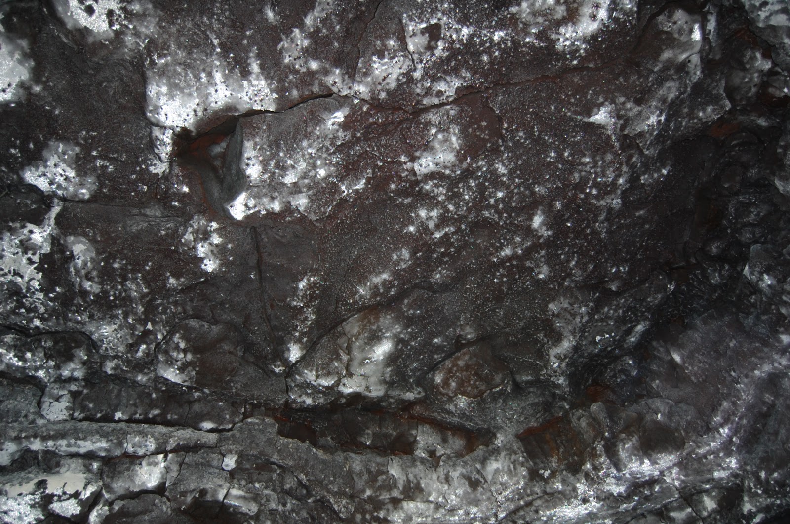
Present on the roof and walls of the cave was a mysterious silvery material that you can see in the picture as well. I don't know what this is, though I would suspect it's some kind of mineral that crystallized on the exterior of the rock as it cooled and hardened (from what I've read, it may be gypsum). It's incredibly beautiful, and reflects light in the dark cave environment like you wouldn't believe.
 |
| A picture showing the cave ceiling where some of the rock as fallen away, revealing more of the mysterious silver mineral behind it. |
The lava tube also contains lots of
lavacicles – which are similar to icicles, just with molten rock rather than water. They form as the lava level in the tube recedes, leaving a clear space near the top where lava can stick to the ceiling then freeze in place as it cools and drips down.
 |
| Lavacicles! Sorry about the blowout on the right there, this was my best picture of them. |
 |
| Another shot of another part of the ceiling. |
Once inside a little way from the entrance, the floor changed from jumbled ceiling-collapse to a slightly smoother surface made up of the last lava to flow through the tube, frozen in place in all its wrinkled glory. This type of surface is known (quaintly enough) as “cauliflower ʻaʻā.” Pure ʻaʻā generally doesn't exist in lava tubes, but this is sort of a transitional form between smooth, ropy pāhoehoe and sharp, angular ʻaʻā.
 |
| The last lava to flow through this tube, now frozen in time, makes up the floor of the cave for quite a while. |
As the flow of lava from the vent cracks of Mauna Loa subsided, so did the amount of lava flowing through the tube. Eventually the last little bit didn't have enough pressure behind it to push it downhill, so it froze in place making up a rough but not unpleasant walking surface (just watch your step! Everything is moist in here).
I just want to take a moment to remark on how difficult it is to get good pictures in caves like this without enough light for the camera to be able to auto-focus. Seriously, it's really hard. You might think that the
astrophotographer, who spends time taking pictures in low-light environments, might have been able to foresee this, but no. I do know to be better prepared for the future, however. I ended up not actually taking too many pictures, something I hope to remedy next time (since there was certainly no lack of things interesting enough to be photographed).
Along the side of the tube wall in places there was a sort of shelf or curb where the lava slowly cooled from the edges in as the inflow was slowing down. You can see it in the picture below:
 |
| At top you can see the cave wall, then the curb in the middle, and the cauliflower ʻaʻā floor at bottom. |
One thing that helped remind us that we weren't that deep underground (all things considered) was the amount of tree roots growing down from the ceiling. There were quite a few of them in places.
 |
| Masses of tree roots hanging down over some roof-collapse rubble. |
Another reminder was the presence of skylights at intervals:
 |
| Skylight in the tube. This scene looks like something you'd find in the early levels of Portal 2. |
While near the skylight seen above, I found some interesting features in the floor. It looks like fossilized bits of tree bark and possibly fern leaves.
 |
| Fossilized organic material embedded in the lava making up the tube floor. |
 |
| More organic material. Looks like tree bark, possibly from the abundant ʻōhiʻa lehua trees in the area. |
Near the end of the cave system a breakdown in the tube let us scramble up the collapsed rock and emerge from its associated skylight. We felt that a nice walk overground was in order to get back to the car, so set off along what appeared to be a trail.
I should mention that we emerged in the middle of an ʻōhiʻa lehua forest with a lot of undergrowth of a particular fern-like plant that I didn't recognize, with no sign of civilization other than the noise of the occasional passing vehicle on Kaumana Drive. Looking on a map, I see that the exit point was no further than 300 meters (1,000 feet) from where we entered, but it felt like the middle of nowhere due to all the trees (it was also on the opposite side of the highway from where we started). The trail we were following very quickly began to appear and disappear as trails in forests are wont to due, so I had to pull out the GPS on my phone to make sure we were actually making our way back to the car.
Also very prominent on our minds was the fear of suddenly falling through a well-covered skylight hidden in the undergrowth. It wasn't always easy to determine what was solid rock footing, what was dirt or organic material, and what was leaves growing over a depression in the ground. ʻŌhiʻa trees don't really make good sticks for prodding the ground in front of you to see if it is in fact ground and not a gaping hole, so we took it slowly and carefully. Thankfully, between GPS and my good sense of direction we made it back to the parking lot where we'd parked without incident (beyond a few mosquito bites), although I'm pretty sure I was blazing my own trail for at least part of the time.
All that climbing around took a bit longer than we'd expected, and after forcing our way through the thick undergrowth we were both pretty tired, so we decided to put off exploring the makai (right-hand) side of the tube until next week, when we plan to return making use of what we learned from this expedition. (For instance, I was surprised at how warm it was in the caves, being used to thinking of caves as cool places. It was cooler than the outside air, yes, but not much, and also very humid so I worked up quite a sweat after scrambling around on rough lava rock piles for an hour and a half.)
Finally, a nice picture of one of the ʻōhiʻa trees we passed while returning:
 |
| A mature ʻōhiʻa lehua tree at about 1,000 feet elevation near the entrance to the Kaumana lava tube. |